The Highlands is a string of Louisville neighborhoods along Baxter Avenue and Bardstown Road in Jefferson County, Kentucky. It begins about 1.5 miles southeast of downtown Louisville and runs about 3 miles out from there. The name comes from its high ground above the forks of Beargrass Creek. Homes from the streetcar era line the side streets, while Baxter Avenue and Bardstown Road carry a long commercial strip of locally owned shops, restaurants and bars. Cave Hill Cemetery and Cherokee Park border it on the north and east.
The Highlands is not one neighborhood but several. Original Highlands, Cherokee Triangle, Tyler Park, Deer Park, Bonnycastle, Highlands-Douglass, Belknap and Irish Hill are all commonly grouped under the name. Each one branches off Baxter Avenue or Bardstown Road, so the commercial strip ties them together.
The strip is mostly older storefront buildings set close to the sidewalk. Louisville Metro has reviewed new building design along it since 1990 through the Bardstown Road/Baxter Avenue Corridor Review Overlay District. Behind the storefronts, the side streets are a grid of houses. At the north end, the gates of Cave Hill Cemetery face Baxter Avenue. To the east, the land drops into the wooded Beargrass Creek valley of Cherokee Park.
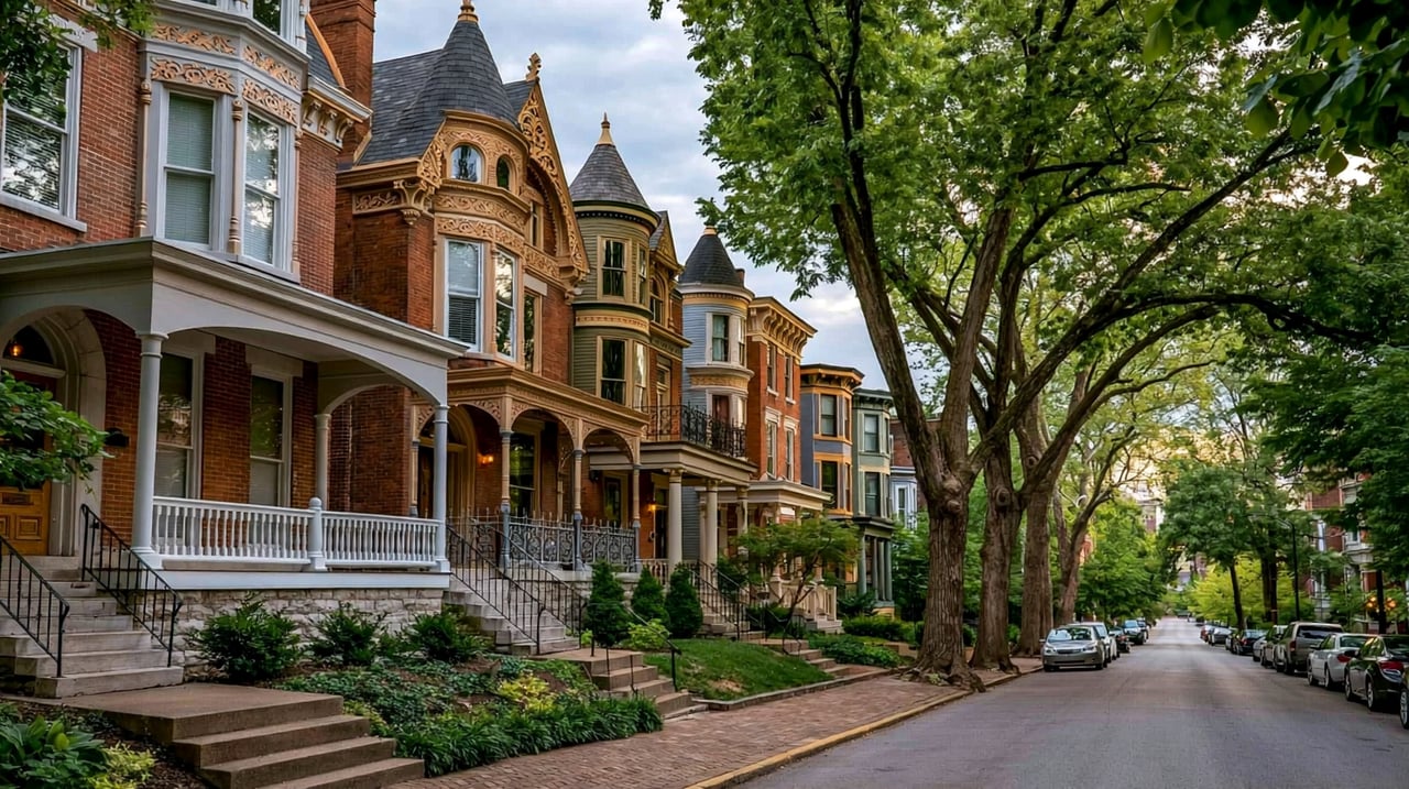
Most homes were built from the late 1800s into the 1930s, as streetcar lines pushed out Bardstown Road. The oldest blocks, near Baxter Avenue in Original Highlands, have Victorian houses and shotgun houses. Cherokee Triangle has larger late Victorian and revival-style houses, and it is a local preservation district with design review for exterior changes. Farther out Bardstown Road, the houses date mostly to the early 1900s. Apartment buildings and older houses split into apartments are mixed in throughout.
Baxter Avenue and Bardstown Road form the main spine. Eastern Parkway crosses Bardstown Road in the middle of the area, and Broadway and Lexington Road lead west toward downtown from the north end. Downtown Louisville is about 10 to 15 minutes by car without heavy traffic, depending on where you start. TARC buses serve parts of the area; check ridetarc.org for current routes.
Start in Cherokee Park and drive or walk part of the Scenic Loop. Then head to Willow Park in Cherokee Triangle and walk west to Bardstown Road. Follow Bardstown Road north toward Baxter Avenue to see the storefront blocks, then finish at the Cave Hill Cemetery gate on Baxter Avenue.
Is The Highlands its own city?
No. The Highlands is a group of neighborhoods inside Louisville, which has shared one consolidated government with Jefferson County since 2003.
How far is The Highlands from downtown Louisville?
The north end, near Baxter Avenue and Broadway, is about 1.5 miles southeast of downtown. The area runs about 3 miles out Bardstown Road from there. Most trips downtown take about 10 to 15 minutes by car without heavy traffic.
Which school district serves The Highlands?
Jefferson County Public Schools (JCPS) is the public school district for The Highlands.
Cherokee Triangle is part of The Highlands: see Cherokee Triangle. Close by are Germantown to the southwest, Butchertown and NuLu to the northwest, and Clifton and Crescent Hill to the northeast.
Properties
A live look at the market, updated every 15 minutes. Tap any home to book a tour.
1,694 people live in The Highlands, where the median age is 38 and the average individual income is $58,169. Data provided by the U.S. Census Bureau.
Total Population
Median Age
Population Density Population Density This is the number of people per square mile in a neighborhood.
Average individual Income
The Highlands has 1,036 households, with an average household size of 2. Data provided by the U.S. Census Bureau. Here’s what the people living in The Highlands do for work — and how long it takes them to get there. Data provided by the U.S. Census Bureau. 1,694 people call The Highlands home. The population density is 10,907 and the largest age group is Data provided by the U.S. Census Bureau.
Total Population
Population Density Population Density This is the number of people per square mile in a neighborhood.
Median Age
Men vs Women
Population by Age Group
0-9 Years
10-17 Years
18-24 Years
25-64 Years
65-74 Years
75+ Years
Education Level
Total Households
Average Household Size
Average individual Income
Households with Children
With Children:
Without Children:
Marital Status
Blue vs White Collar Workers
Blue Collar:
White Collar:
Connecting you to the area
Guides to what each area is like to live in, what is for sale, and what homes are selling for.