Clifton is a hillside Louisville neighborhood on Frankfort Avenue, about 2.5 miles east of downtown Louisville in Jefferson County, Kentucky. It is bounded roughly by Mellwood Avenue on the west, North Ewing Avenue on the east, Brownsboro Road on the north and Interstate 64 on the south, with Frankfort Avenue running through the middle. Most of its older homes date from the late 1800s and early 1900s, and much of the area is in the Clifton Historic District on the National Register of Historic Places.
Frankfort Avenue is the main street, with a rail line running beside it. Locally owned restaurants, coffee shops, antique stores and galleries line the avenue, and Louisville Tourism counts this stretch, with Crescent Hill, as one of the city's restaurant rows. The streets climb and dip, since Clifton is on the hillside above the Ohio River valley, and the side streets are lined with older houses and trees.
The American Printing House for the Blind, founded in 1858, has its headquarters at 1839 Frankfort Avenue, next to the Kentucky School for the Blind. Across the street is the Clifton Multisensory Art Installation, a mural of hand-carved ceramic tiles.
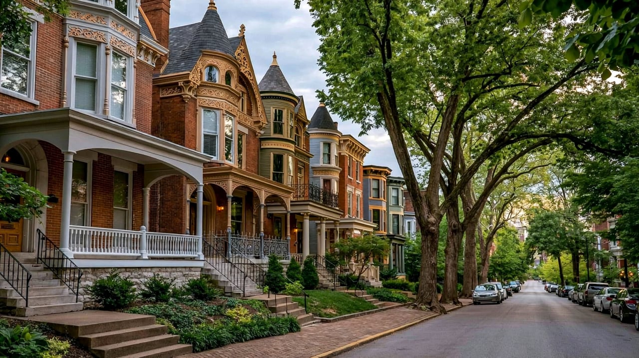
Many of Clifton's older houses were built in Victorian-era styles, including Italianate, Queen Anne and Gothic Revival, with some Classical Revival. Because building went on for decades, houses of different ages and styles often stand side by side.
Frankfort Avenue and Brownsboro Road run east to west through Clifton, and Mellwood Avenue runs along the west side. Interstate 64 forms the southern edge. Downtown Louisville is about 10 minutes by car without heavy traffic. TARC buses serve parts of the area; check ridetarc.org for current routes.
Start at the American Printing House for the Blind at 1839 Frankfort Avenue and look at the tile mural across the street. Walk east on Frankfort Avenue toward Ewing Avenue, stopping in the shops along the way. Then continue into Crescent Hill and walk the reservoir loop.
Is Clifton its own city?
No. Clifton is a neighborhood inside Louisville, which has shared one government with Jefferson County since 2003.
Is Clifton a historic district?
Yes. The Clifton Historic District was listed on the National Register of Historic Places in 1983, and a boundary increase was added in 1994.
Which school district serves Clifton?
Jefferson County Public Schools (JCPS) is the public school district for Clifton.
Crescent Hill continues east along Frankfort Avenue. Butchertown is just west past Mellwood Avenue, and The Highlands is south across Interstate 64.
Properties
A live look at the market, updated every 15 minutes. Tap any home to book a tour.
3,967 people live in Clifton, where the median age is 39 and the average individual income is $43,602. Data provided by the U.S. Census Bureau.
Total Population
Median Age
Population Density Population Density This is the number of people per square mile in a neighborhood.
Average individual Income
Clifton has 1,947 households, with an average household size of 2. Data provided by the U.S. Census Bureau. Here’s what the people living in Clifton do for work — and how long it takes them to get there. Data provided by the U.S. Census Bureau. 3,967 people call Clifton home. The population density is 7,100 and the largest age group is Data provided by the U.S. Census Bureau.
Total Population
Population Density Population Density This is the number of people per square mile in a neighborhood.
Median Age
Men vs Women
Population by Age Group
0-9 Years
10-17 Years
18-24 Years
25-64 Years
65-74 Years
75+ Years
Education Level
Total Households
Average Household Size
Average individual Income
Households with Children
With Children:
Without Children:
Marital Status
Blue vs White Collar Workers
Blue Collar:
White Collar:
Connecting you to the area
Guides to what each area is like to live in, what is for sale, and what homes are selling for.